Tundulu, Malawi Rare Earths Project
The Tundulu Rare Earths Project covers 91.5 km2 within exploration licence EL 0731/24 in the Phalombe District of south-eastern Malawi, approximately 90 km east of Blantyre. Tundulu is a 7.5 km carbonatite ring complex - one of the largest and most under-explored rare earth systems in the country.
The project sits within an emerging world-class REE district alongside:
- Kangankunde(Lindian Resources) - 261 Mt @ 2.19% TREO, ~A$1.5B market cap, under construction
- Songwe Hill (Mkango Resources) - 21 Mt @ 1.41% TREO
All-weather road access links the project to regional centres, with national grid power at the nearby town of Migowi.
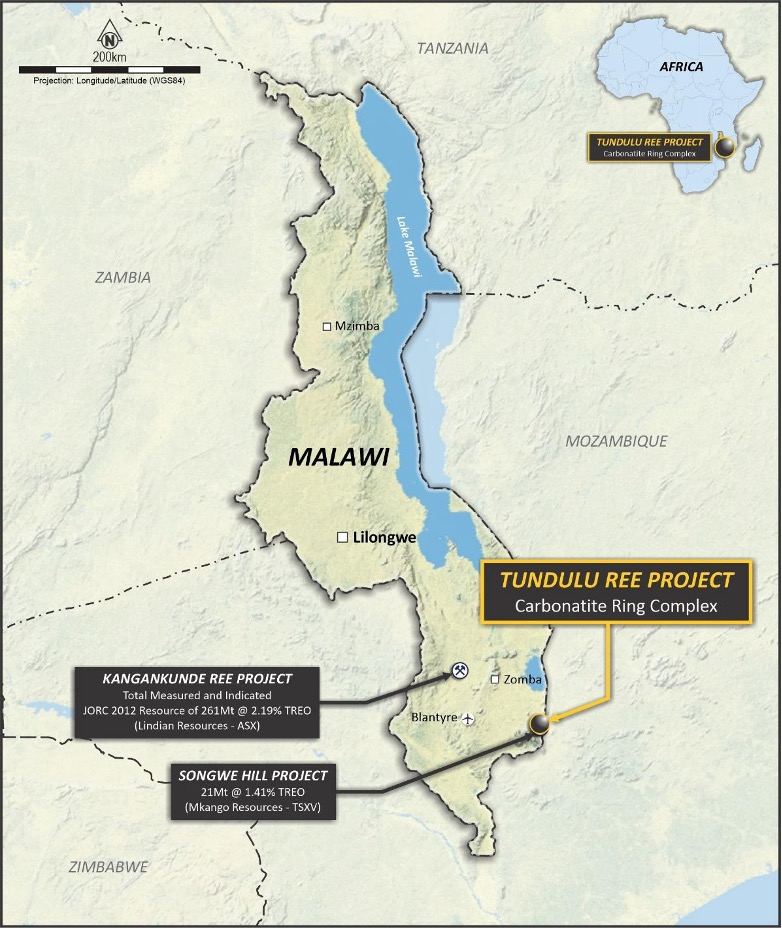
Tundulu Project location within southern Malawi’s emerging rare earths district.
Geology and Mineralisation
The complex comprises several hills arranged around a central agglomerate vent at Nathace Hill. Five topographic highs have been identified - Nathace Hill, Tundulu Hill, Makhanga Hill, Namuka Hill, and Ichigwakalu Hill of which only Nathace Hill has been subject to significant drilling.
REE mineralisation occurs in two carbonatite types: a rare earth-rich carbonatite and an apatite carbonatite. The apatite carbonatite also carries high-grade phosphate (up to 97m @ 14.4% P₂O₅) with excellent bioavailability, representing a potential co-product opportunity. Mineralisation is enriched in valuable medium rare earth elements (MREEs) with low uranium and thorium levels.
Historical Drilling
Two major drilling programmes have been completed at Nathace Hill:
- JICA (1987) - 27 diamond holes for 1,205m (max depth 50m)
- strong>Mota-Engil / Optichem (2014–2015) - 55 holes for 7,002m (average depth 127m, deepest 221m)
Headline intersections include:
- 41m @ 3.7% TREO from 8m (JMT-22, ending in mineralisation)
- 30m @ 4.03% TREO from surface (TU014)
- 35m @ 2.7% TREO from 15m incl. 14m @ 4.1% TREO (JMT-17, ending in mineralisation)
- 15m @ 3.46% TREO from 73m (TU071)
- 31m @ 2.27% TREO from 41m (TU048)
A total of 24 holes ended in mineralisation, with eight terminating in grades exceeding 2% TREO — confirming the system remains open at depth. Rock chip sampling has returned up to 6.41% TREO at Nathace Hill and 6.07% TREO at Tundulu Hill.
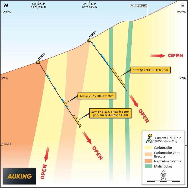
Cross-section of western Nathace Hill showing REE mineralisation open at depth.
Exploration Upside
Four of the five identified topographic highs across the complex remain largely untested by drilling, despite confirmed carbonatite geology and anomalous surface geochemistry. Planned exploration includes:
- Drone-based LiDAR and aeromagnetic surveys to map structural controls on mineralisation
- RC and diamond drilling targeting extensions at Nathace Hill to the north, south, and west
- First-pass drill testing at Tundulu Hill, Makhanga Hill, Namuka Hill, and Ichigwakalu Hill
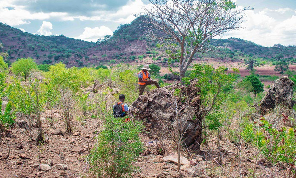
Tundulu Hill geological setting enriched with carbonatite outcrops and Nathace Hill in the background.
Cautionary Note
Historical exploration results referenced above have not been reported in accordance with the JORC Code 2012. A Competent Person has not completed sufficient work to disclose these results under JORC 2012. It is possible that following further evaluation, confidence in prior results may be reduced. AuKing has not independently validated the former owners’ exploration results and is not to be regarded as reporting, adopting, or endorsing those results.